Chaitén – a town in the line of fire
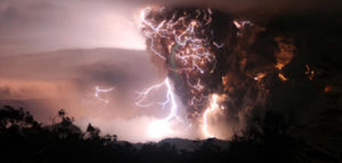
In May 2008, Chaitén volcano in Chilean Patagonia erupted and provided the world with spectacular footage of the first rhyolitic eruption ever to be observed in modern times. But the 2008-2009 Chaitén eruption is not only remarkable from a geological point of view, but also in regards of its short- and medium-term crisis management and social implications. This November, volcanologists of all trades – geochemists, geophysicists and social scientists – gathered in Chaitén for four days, to study the volcano, the 2008-2009 eruption dynamics and its effects on the town and the broader environment. A most enlightening experience I feel lucky to have made, thanks to the generous support of the EAG, which funded my attendance of the accompanying ‘Cities on Volcanoes’ conference as an EAG ambassador.
‘We want people to feel safe again.’ Chaitén’s mayor Pedro Vásquez Celedón sounds positive and persuasive as he is welcoming us, some 20 volcanologists, in the new cultural centre of the Northern Patagonian community. But in direct line of sight, the steaming dome of Volcán Chaitén tells a different kind of story: its most recent eruption in May 2008 flooded the largest part of the town with suspended ash and rendered it temporarily inhabitable. The river draining the volcano had got overloaded with volcanic ash and chose a new channel – one of the town’s streets.
When settlers founded Chaitén in 1940, they had no idea there was a dangerous volcano slumbering at the end of their valley. In fact, locals didn’t realise that until the night of May 2nd, 2008, when the volcano exploded and hurled ash to an altitude of more than 20 km. In a meeting with residents, they tell us how earthquakes got stronger in the weeks leading up to the eruption, but no one made a connection to Chaitén volcano, including the Chilean Geological Survey (SERNAGEOMIN), which wasn’t monitoring the volcano at the time. In the hours before the eruption began, people got terrified by the constant strong rumbling and shaking of the ground, and some left the town in a hurry. Once the eruption had set on and ash and pumice started raining on the town, the Chilean government reacted promptly and evacuated about 4000 residents within 24 hours, mostly by boat. On May 6th and May 8th, two more Plinian pulses of activity occurred, and a 50 km evacuation zone was established in response, with a total of 7300 people evacuated. Thanks to the efficient crisis management, Chaitén town was deserted and no one was harmed when minor rainfall caused voluminous lahars and the overspilling river flooded the town on May 10th.
Explosive activity waned by May 12th, and the eruption entered a dominantly effusive phase that was to last until early 2010. Hot rhyolitic magma with low crystal contents was extruded at high rates (up to 66 m3/s) and formed a lava dome of about 2 km diameter and 200 m height within a few months’ time. As part of the touristic development of the region, a path to the caldera rim has recently been opened, which allows truly stunning views on the steaming dome and its several lobes, spines, and small pyroclastic flows. The hike up through an obsidian-and-pumice-spotted landscape that has just started recovering from being inundated by pyroclastic flows is just as awe-inspiring.
As the dome was growing high enough to be seen from Chaitén town in 2009, there was still nobody living there. The zone officially was still declared inhabitable by the government, and former town residents were staying in Puerto Montt and other major cities in the region. The Chilean government had responded pragmatically to the volcanic eruption and the destruction it caused, by making plans for a complete relocation of the town to Santa Barbara beach, a sheltered bay 10 km north of Chaitén town. They hired city planners and architects to pitch a vision of ‘Nueva Chaitén’ to the people of Chaitén, and even started building an airport and provisional administrative facilities on the beach. But locals felt that the planned houses didn’t look like their homes (for example, the windows were designed way too big to resist the strong Patagonian storms) and rejected all plans of relocation declaring they wouldn’t let themselves be uprooted. They created facts by gradually moving back to Chaitén town and protesting against the government’s plans. In early 2011, running water and electricity got reestablished in the northern part of town; ferries started reoperating between Chaitén and the local centre Puerto Montt; school classes resumed in March 2011. Consequentially, in April 2011, the Chilean government declared the northern part of town habitable and announced plans to rebuild the city on site. As we visit Santa Barbara today, the site where Nueva Chaitén was supposed to flourish, we find nothing but a few lone houses and a rusty, withering fishing boat.
Today, more than eight years after the Plinian eruptions, Chaitén shows two very different faces that are separated by the river that once was a street. The northern part of Chaitén town is looking snug, boasting hotels, hostels, restaurants, shops, and outdoor excursion providers. A few ash-covered houses are left alongside the regulated riverbed – they will be conserved as a walkable museum, very much like Pompeii.
South of the river, ash-covered ruins are not a museum feature, but everyday reality for the people that started settling here despite the governmental refusal to declare this part of town habitable. There is no electricity and running water, and people are living in more or less makeshift houses; local patriotic, fierce graffiti cover the flooded ruins. It seems likely that locals will also win this second battle against the Chilean government and have the southern part of Chaitén officialised as well.
What can we learn from the story of the 2008 Chaitén eruption and its aftermath? I believe it showcases two crucial issues volcanologists and communities close to volcanoes are facing today:
Firstly, Chaitén’s unexpected, moderate rhyolitic eruption shows us in a rather mild way that the most hazardous volcanoes are the ones that we don’t know about, or that we are not monitoring. The fact that there were no casualties during the Chaitén eruption is undoubtedly thanks to the rapid emergency response of the Chilean government and SERNAGEOMIN. But had the eruption unfolded in a way that would have swept the town at a much earlier point, the lack of a monitoring- and alert-system might have proven disastrous. Communities living less than ten kilometres from an explosive eruption vent will not always be as lucky as Chaitén has been. The Chilean government and SERNAGEOMIN have learnt their lesson from the Chaitén eruption, and have established a national real-time monitoring and volcano hazard assessment program, covering half of Chiles 90 active volcanoes, with two additional observatories planned in Southern Chile.
Today, monitoring tools are powerful enough to give us a grip on the current behaviour of a volcano, and tied with a scientific understanding of the eruptive history and pattern of a volcano we can prepare appropriate emergency plans and mitigate any hazard. Obvious volcanoes like Chaitén, with an obvious lava dome since at least 5000 years, are low-hanging fruit and easy to monitor – given the financial means. The next, bigger challenge for modern volcanology are volcanoes that haven’t been active in historic time, or that we simply haven’t spotted yet (Not all volcanoes are perfect cones like Fuji!). Geochemistry will be a fundamentally important tool to prospect for previously undiscovered volcanic fields.
Secondly, the case of the failed relocation of Chaitén drastically shows us the limits of our efforts to keep people safe from volcanic hazards. Clearly, Chaitén is not a safe place: It sits 10 km from a fuming volcano that will erupt again at some point and send pyroclastic flows and lahars right down the valley at the end of which Chaitén is located. Clearly, Santa Barbara would have been the place where people could actually feel safe. But they wanted to return to their homes, to the place that their great-grandfathers have founded, and where they built themselves a life. Hazard perception and appraisal is not something that works solely on a rational level, and to many people being uprooted seems to be worse than the idea of dying.
People are working hard to make Chaitén an attractive place to live and a tourist destination again; they are sanguine and proud. The decision to come back and feel safe again might not be a rational one from a volcanologist’s point of view, but we have to assume that after what locals endured in 2008, it is an informed and conscious decision that we have to respect.
About the author

Martin Mangler is a third-year PhD student at Imperial College London / Natural History Museum London. In his research, he uses geochemical and petrological tools to elucidate the plumbing system of Popocatépetl volcano, Mexico, and to improve our understanding of the transition between effusive and explosive activity at arc volcanoes. He is actively involved in volcanic hazard education and other science communication events both in Mexico and the UK.
